CREATE A CATALOGUE FOR MASSIVE GEOLOCATED IMAGES WITH ARLAS v19
The Internet's photo-sharing portals have billions of publicly available images captured practically anywhere on the planet. These photographs are frequently annotated with various types of information (metadata), such as location, time, photographer, equipment and a wide range of textual tags.

It is not always easy to find the image you want among a massive image dataset. ARLAS is an open source solution to explore massive geolocated datasets in a map application.
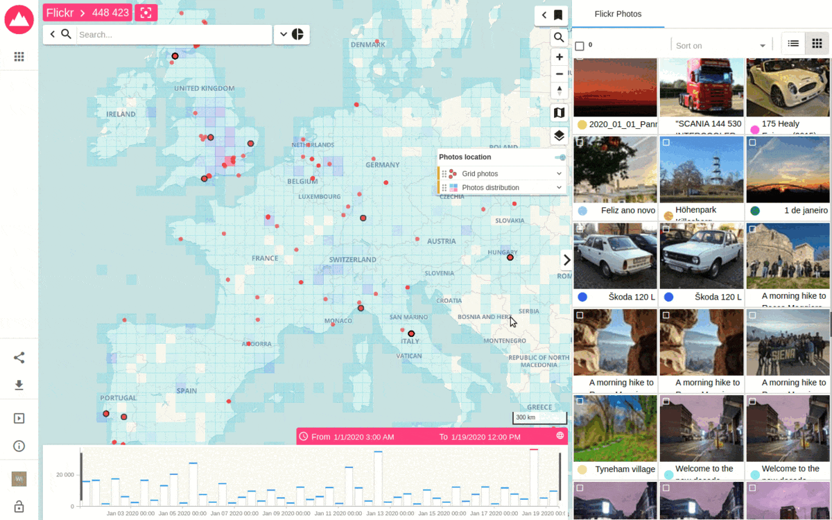
The exploration of image metadata allows users to choose the image according to its properties. For example, you can explore a sample of Flickr image metadata. As shown below, ARLAS v19 now lets you display a datatable on the right side of the application. Here the table displays the date and the name of the photos. The “details” section provides the other information about each photo.
But sometimes displaying an image is better than text and numbers. It is now also possible to display images to create an interactive image catalog. As shown here

You can extend this vignettes section to a grid to see more images.

As you don’t want to superpose all the images when they are numerous. It is now possible to configure a layer as “scrollable features”. It displays only a sample of selected images (for example the most recents ones corresponding to selection).
The images displayed on the grid are underlined on the map to recognize them. When we scroll the grid, it changes the underlined images.
Finally, once the image is chosen, you can download it directly in the best quality and start using it.

ARLAS 19 allows you to quickly find the image you’re looking for.

NB: ARLAS can adapt to any image server. There is no need to download and index all the images. Only the metadata are indexed in ARLAS, the image server is called to preview images and download it.
Get Started
ARLAS version 19 documentation is already available here on our website and also captured on Github. You can also access our live demos where you can see the results of all the possibilities in place. Once you are ready to start, consult our tutorials and let us know how you are using ARLAS.