ENHANCED TEMPORAL FUNCTIONS FOR GEOSPATIAL BIG DATA ANALYTICS
ARLAS V18 RELEASE
If you are an ARLAS user or enthusiast you probably know that the timeline is one of ARLAS’s key functions. Because, what is temporal analysis without a timeline? Right? So when we build new features into ARLAS, we immediately link them to the timeline.
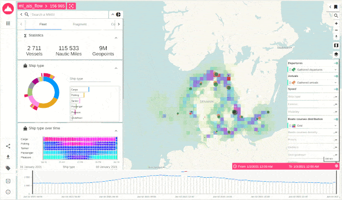
In the last ARLAS update, version 17, we gave you the multi-collection feature which allows you to pull in diverse data sources and display them on the same map. The new ARLAS v18 not only lets you display the spatial aspects from your multi collection, you can now also visualise the temporal distribution of each data set across the timeline.
Each collection is represented by a line.
Get Started ARLAS version 18 documentation is already available here on our website and also captured on Github. You can also access our live demos where you can see the results of all the possibilities in place. Once you are ready to start, consult our tutorials and let us know how you are using ARLAS.
ARLAS version 15 release is out for instantaneous geo-big data analytics! Read this article for more information.